It was a dampish Friday morning when I took the next steps on the Coastal Path. The final day of a week off work and although the weather forecast was mixed, I had decided to make the most of that final day’s freedom and made the 120 mile journey in hope of dry weather rather than expectation. I parked up in the same small car park in the middle of Pentraeth with moisture in the air but with a distinct improvement on the heavy drizzle that had welcomed me onto the island an hour or so earlier - I will confess to having taken the opportunity of a bacon butty in a café in Beaumaris as I let the worst of the rain pass. Despite the inclement weather, I decided to leave the majority of my stuff in the car, taking only my waterproof and baseball cap with me in addition to the guide book and Ordnance Survey map - whatever else, I would stay relatively dry and know where I was. I did this in the full knowledge that there were three villages in the six miles of the route where refreshments could be obtained, so I was hardly leaving myself open to the risk of starvation or dehydration.
The village of Pentraeth (The End Of The Sands) is situated about a mile from the coast - two miles if the tide is out - but it’s a pleasant enough amble by way of quiet road, narrow pathway and gravel lane, before the official route is reached at Pen-y- Lon. I’m unsure how old the cottage is that stands immediately alongside the path at the point my route joined it, but it has certainly been recently renovated I would suggest. It was advertised as being available for holiday accommodation, sleeping six in three bedrooms (one containing bunk beds - so a maximum of four adults was allowed) and I immediately began to run through in my mind who could join me. The location was magnificent - views from large picture windows across the full sweep of Red Wharf Bay - and the cottage itself appeared immaculate. It looked contemporary, yet very much a part of the landscape, and caused me to rethink my preconceptions about the Welsh architecture. In my mind’s eye I had seen dark, dingy, grey slate cottages and pebble-dash; the reality was bright, white and attractively modern. The garden was tucked away behind a glorious stone wall, with a bulge at the far end that suggested a pulpit or the prow of a ship. I fell in love with the property straight away and it was only as I continued along the beach that I began to consider the practicalities - what did you do when the weather rolled in and you’d forgotten to get the milk in? What would the approach road do to the car’s suspension (a major consideration this in the week I had spent £300 on a new exhaust)? And who would do the window-cleaning of all that glass in the picture windows? I came to the conclusion that I would not be putting an offer in for the property just yet - although should I win the lottery, things might change.
 My route lay to the north-west and I was soon walking through that same mixture of sand and salt marsh that we had plodded through at the end of the previous stage, enjoying the sights and sounds of the seabirds away to my right. The tide was slowly ebbing but had yet to expose the majority of the sands completely, although knots and oystercatchers and sandpipers were happy to dabble in the shallows for the shellfish that were in course of being revealed.
There are other cottages dotted along the foreshore, the majority of them also white-rendered and desirable with pretty gardens and wonderful views, but none had the magic of that first cottage. They did, though, have a glamour that I was surprised to find. My memories were of a 1970s long-gone, the past another country where things (and buildings) were done differently. I wanted to update these memories, find new ones that I could return to a further thirty years down the line, store them away with those of my childhood to be brought out in older age - and also in those years intervening .
The path skirts along the foreshore, muddy in parts, rocky in others, with wooded slopes coming to the very edge of the beach in a feature unusual on Anglesey. It is rare that you can have one foot on sand and one on the roots of a sycamore but it is an attractive backdrop. Across the bay, large container ships moved seemingly at a snail’s pace in the direction of Liverpool, the Mersey and all points east. Much closer I was pleased to see a grey heron as it took to the air, initially clumsy but soon stretching its neck and - with legs trailing - gracefully flapping its way across the bay towards the eastern end and the wooded hills beyond. A second, third and fourth followed along behind. I hadn’t seen them before they took off, but it is always a pleasure to see one of my favourite birds and it was with a big smile on my face that I moved on to the Ship Inn and the quayside.

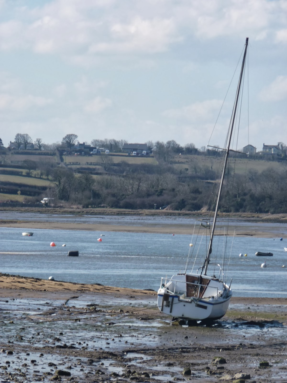 Three hundred years ago, it is possible that the equivalent of those container ships would have been looking to dock here, at the Red Wharf - apparently named for the colour of the sand after a particularly bloody battle here in Viking times. It is only three hundred years ago that the now quiet hamlet was a busy port but the advent of rail transport and steamships soon put paid to that lucrative commerce and it is now tourism, like so many villages on the coast, that sustains the community. Small yachts at anchor now dot the bay, the breeze causing that familiar noise of wire halyards on metal masts. Waters are shallow here, even at high tide, and the bay has seen its fair share of shipwrecks over the years - although as we shall see, there are more dangerous rocks but a few short miles north.
I ignored the Inn’s charms on this occasion, preferring to push on whilst the sun shone, however weakly. I was soon distracted, though, by the presence of a white egret, sifting through the mudflats in search of food. If global warming is a fact of life, then we can hold the egret up as one of its more beneficial impacts as it becomes increasingly common within the UK. The books that I have read - including Mark Cocker’s wonderful “Birds Britannia” - indicate a preference for the south and east coasts but I can see little chance of confusion and can only assume that they continue to expand their territory.
The path joins up with the tarmac road for a few yards and passed by in front of a spanking new apartment development. This was the first of the buildings that jarred with my sensibilities a little bit - it wouldn’t have looked out of place in a city centre but seemed a little awkward here - but another modern building beyond again fitted in perfectly (or would do once the brightness of its orangey terracotta paint had weathered down). Indeed the cottage on the right was perhaps the ugliest of the day - no doubt some hundred plus years old but looking a little uncared for, a little shabby, unkempt. It is perhaps overshadowed by the obvious money spent on the surrounding properties but now seems a little bit dark and dingy in comparison.
The footpath now climbs back on itself, away from the foreshore for a while as it wends its way up to and bisects a substantial caravan site before it sets its sails towards Benllech. The site occupies a good few acres up to and including the prominent headland. The facilities look pretty good - there is a “clubhouse” and what appeared to be a full sized football pitch and large children’s playground - but I do have a bit of a problem with caravans and caravan sites, finding them soul-less and boxy. Indeed the first view of Benllech is seriously marred by the prominence of the large site above and beyond the village (although the village itself seems to consist of the same identikit bungalows and little houses that I remember from so many years ago.)
 Beyond the last of the caravans the path could either take to the beach once more or follow the high tide alternative. This option sticks close to the sedimentary rock walls in whose shade a micro-climate has created a lush layer of undergrowth and scrubby trees and shrubs through which a wooden walkway has been built, clambering up and down slippery staircases and over muddy expanses where water runs off the vertical walls above. The rock’s different layers are clearly defined and it would come as no surprise to learn that a combination of water action draining through from above and high tides from below had caused a number of landslides over the year and a gradual receding of the coastline in the way that can be seen on the east coast of England, with hotels every so often disappearing over cliff edges and the loss of whole villages to the sea over the course of hundreds of years. The path is a well-made one but it loses something by being away from the shore, there are few views and those rock walls mean they are only in the one direction anyway. After what has gone before, this section is undeniably a little dull. It feels especially so when it passes in front of a water purification plant and joins its concrete service road for a quarter mile or so before dropping down to the end of Benllech’s “promenade”.
The village of Benllech developed not as a fishing village or port but rather as a “resort village” during the early twentieth century. It is this “new town” feel that is probably responsible for the uninspired architecture that I mentioned earlier. We first came to Anglesey as a family in the early mid-seventies when Mum, Dad, me and younger brother Steve stayed in the village in a rented “cottage” - in reality one of those identikit boxes on an identikit estate off the main road situated up the hill in the village proper, rather than on the actual coast itself. I can remember little about the house itself (it may even have been a bungalow) but do remember a tiny bookshelf, the only book it contained that I had heard of being John Bunyan’s “Pilgrim’s Progress”, and I also remember finding a knobbly green football abandoned in the back garden that we enjoyed playing with and “liberated” back home to Rugeley with us, where it enjoyed a happy and fulfilled life being kicked around back garden and field until being forgotten about and liberated by someone else in turn. I also remember the little sketch book with simplistic yachts and lighthouses on the cover with which we were expected to entertain ourselves in the evenings - no television or wi-fi internet connection in holiday homes in those days; we had to make our own entertainment. Nonetheless, I remember it as a happy holiday - although I don’t remember any that weren’t - and look back on those days with fondness.

I had visited Benllech only a couple of years previously, when business had brought myself and Dave - a work colleague - to the island. It was Dave’s customer that brought us to Benllech and I passed their B&B and restaurant as I wandered along the road parallel to the beach. That day had been a bitterly cold and pretty miserable March Sunday where views had been extremely limited but the customers had been pleasant and the meeting an amiable one. However, there was no sign of them as I passed their establishment - no sign of anyone - and I strode on to a café on the corner of the road as it turned sharply uphill. It had become increasingly warm and humid during the morning and having made the decision to travel light, I was feeling the need of liquid refreshment so decided to pop in for a pot of tea. The menu was extremely appetising and I allowed myself to be tempted by a bowl of rhubarb and apple crumble with custard. The food was excellent and the atmosphere light and airy - I enjoyed the place thoroughly and the sight of “reserved” notices on a number of the tables implied that it was doing something right. I hope it continues to be successful.
I’ve a sneaky feeling that the building used to be a gift shop and may have been the very one where used my holiday money to buy a pack of Top Trumps - probably at the height of their popularity that summer as I see on Wikipedia that they were first launched in 1977 which puts us at pretty much the exact target market I would have thought. The spending of holiday money was quite a moment - careful consideration had to be given to the purchase, and whilst it burnt a hole in your pocket it wasn’t particularly clever to go and blow it on the first day and then regret your impetuosity when you saw something later in the week that you wanted even more. This holiday money came from Nana and Grandad, handed over with the instruction to “buy yourself an ice-cream” - of course the amount received was far greater than necessary for an ice-cream and it would be many years before we were expected to buy our own but tradition had to be observed and I will no doubt mutter the same to Ted as I give him a little something when he understands money a little better.
 The official guide book had proved entirely sufficient for route-finding during the course of the morning (with the excellent signposting, it could largely have consisted of the words “Keep the sea on your right”) and it didn’t take long to read up on what lay ahead of me over the tea and crumble, but I couldn’t help but notice the italicised sentence “The cliffs rise to almost 30m in places and the path passes quite close to the edge so care is needed here and there”. I’ve never been good with heights and, although I am better than I was as a child, can still be reduced to frozen immobility by the thought of a long drop to my side. It was with some temerity, therefore, that my footsteps turned uphill between thick hedgerows. Clematis and honeysuckle hung over from the tiny gardens adjoining the caravans beyond the left hand side; harebells and wild roses sprouted to the right. Hedge trimmings underfoot lay testament to the care taken to keep the pathway free of impediment and it is obvious that the path is well looked after in general - over the next couple of miles there is almost certainly a constant battle to keep the vegetation from taking over as the path is probably no more than six feet wide and hemmed in by gorse and hawthorn and ivy on either side, with the taller shrubs and bushes often overhanging and creating a series of tunnels beneath which a taller walker will need to duck.
 Whilst the guide book did go on to mention that thick vegetation meant that only occasional glimpses of the cliffs beyond could be seen, these glimpses were quite enough for my imagination to be working overtime and the knowledge that there was a substantial drop to the right meant that I was pretty nervous for the next forty five minutes. I found myself getting more and more crouched to lower my centre of gravity and leaning further and further left to mean that if I DID slip, I would be doing so uphill. Each time I came to a short gap in the vegetation, I had to steel myself before scampering hobbit like across to reach the sanctuary of the hedgerow the other side. Although I could hear the occasional conversation of fishermen on the rocks below, or in tiny boats bobbing in the sea swell, it was fortunate that I did not meet a soul between leaving the café in Benllech and arriving at a collection of wooden chalets - had I done so I would have been forced to walk upright and feign a nonchalance that I was far from feeling. It would have to have been a thin person to squeeze past as well - there was little enough room to stand back and allow someone through, especially when I was going no closer to the edge than the middle of the path - and then only if I could not find secure footing further uphill.
Halfway round the headland, the vegetation disappeared as the path led down to a level grassy area and I was able to enjoy the views seaward without that frisson of fear. This, I hoped, was the start of a less elevated section. Then I looked beyond and was taken aback to see the path plunge into yet deeper vegetation and quite clearly climb more vertiginously than anything that had gone before. I was tempted to turn around and repeat my steps of the last half hour but gave myself a strict talking to, crossed my fingers and strode manfully (!) onwards. Again, my steps had a hobbit-like scurrying quality and the heat and humidity meant that I was now sweating profusely but the rain continued to hold off and I was at least able to laugh at myself as I made my ungainly way around the headland and towards Penrhyn, Traeth Bychan and Moelfre.

Finally I was released from my torment, the path descending sharply towards a lodge or chalet sat up overlooking the bay of Traeth Bychan and across to the village of Moelfre. Although the path is obvious beyond the chalet, and there is nothing but grass surrounding it with no boundary markers such as fence or hedge to mark ownership, both the signpost and the guidebook are clear - you must make a tour of the promontory to reach the far side rather than cut the corner. Being a law-abiding sort of chap, I did precisely that - but it did seem a little pointless, given the proximity of the path to other chalets in the same development. Whilst these are as uniform as the caravans I had disparaged earlier, at least the chalets are dotted around in a more sparing and naturalistic fashion and don’t have the visual impact that the caravans do.
The beach of Traeth Bychan is initially shingle, with stones smoothed by the tide action and wonderfully tactile as a result and it is some yards before the sands are reached. As I walked along these sands I was surprised to see the remains of two jellyfish, obviously stranded here as the tide receded during the course of the morning. I could not remember having seen jellyfish remains like this before and to see two in such close proximity took me a little aback - of course, it could be that I was merely more observant today than I was during my formative years!

Traeth Bychan was the focus of national attention, if briefly, some seventy odd years ago when the wreck of the HMS Thetis submarine was brought ashore here, having sunk during sea trials with the loss of 99 lives. The disaster occurred in Liverpool Bay on June 1st 1939 as a consequence, it appears, of a fault with one of the doors on a torpedo tube registering as closed when it was actually open - as a result, the inner door was opened and water poured in, lowering the bow and taking it to the seabed. Rather like the Russian “Kursk” so many years later, the deaths were as a result carbon dioxide poisoning as the air became stale given the overcrowded conditions - in addition to the normal crew, there were also naval observers and shipbuilders aboard. Three months later, the salvaged ship was brought ashore here due to the ease of access - the beach slopes shallowly and there are few immediate hazards - although as we shall see, they are not too far distant! At the time, the public’s attention was elsewhere, for it was on Sunday September 3rd that the operation came to fruition and the very war for which the submarine was being prepared was in course of being declared. A legal case was brought against Cammell Laird, the shipbuilders, by one of the widows but the Admiralty decided that this was against the public interest and the case failed as they were able to prevent disclosure of much salient information. The Thetis was recommissioned a year later and saw active service in both the Atlantic and the Mediterranean under its new name - HMS Thunderbolt - before she was sunk for a second time, on this occasion by an Italian ship, finally succumbing on 14 March 1943. As a result of the initial problem with the torpedo tube, all subsequent British subs have been fitted with a “Thetis clip”, which prevents such a problem from recurring.
Although the incident took place some miles to the east of the island, the Thetis tragedy is now indelibly linked with Anglesey and takes its place in the lore of maritime disasters. It will not be long until we come across evidence of further incidents - this time with no doubts about the part that Anglesey’s rocks and waters played in the tragic stories that will unfold.
On the far side of the beach, beyond the Sailing Club building, the path wanders through a field or two, dodges through a farmyard and then along another couple of fields with views out to sea. I was starting to look forward to reaching the village of Moelfre and journey’s end for the day when I became aware of a row of swallows sitting on the barbed wire fence to the right of the path, almost as though they were watching the other birds swooping low over the grass in search of insects. As I got closer the more sensible four or five of them took to the air but the last one seemed to realise that I carried no threat and was content to remain seated and take in the sun. Ten yards away I paused, wondering how close I would be allowed to get before he took flight. Step by step I went, slowly and as silently as I could. Eight yards; five yards; four; three; two. I stopped again, unwilling to scare this brave little bird that had been in southern Africa just two or three months previously, before its annual migration across the Sahara Desert and the hunting grounds of Spain and France. After going through all that, what cause did he have to worry about a harmless bird-lover coming within touching distance. A minute went by; two maybe. Never had I been allowed so close for so long to such a small bird - or even a large one! I could see every detail, every feather almost. There is a wonderful cover photo on one of Mike Oldfield’s many Greatest Hits albums of a swallow swooping low over a stream or pond - I bought it for the music but loved it for the cover and yet I had never properly looked at these birds before and I found that I had yet another of our feathered friends to fall in love with. I never did get closer than two yards, but for a couple of minutes I forgot everything that had gone before today, forgot Moelfre, forgot the bus I had to catch and just focussed on a three inch ball of feathers that captivated me completely. I hadn’t expected to even see a swallow today and yet it was the undoubted highlight - and this is why I so love walking because had I not been on foot I would have had no opportunity to see such a thing.
 The swallow finally seemed to feel the need to stretch its wings and so disappeared across the field, returning to the gate through which I had just passed along with three or four friends mere moments after I left the field myself. The path led down onto a series of flat rocks and into the village. Unlike Benllech, the village of Moelfre is inextricably linked to the sea, a fishing village that has expanded over the years and is now more of a tourist spot but still unspoilt to my eyes. Although the core of the village has been here for time immemorial, it expanded during the nineteenth century to include those properties that cluster around the port and its seawall today.
 The path follows this seawall and I continued along it until I reached the Seawatch Centre, a purpose-built building housing an exhibition about the maritime history of the area, in particular the RNLI and the famous shipwrecks in the treacherous waters around the island. The exhibition is centred around a recently retired lifeboat, not from Anglesey but from Ceredigion in South Wales. The lifeboat is named “Birds Eye” and was funded by the eponymous frozen food company and their customers, sending in tokens from the packaging of fish fingers and other products during 1969. The boat was launched one rainy evening in the summer of 1970 in the harbour at New Quay. How do I know it was a rainy evening? Well there is a photo in the family collection of my near four year old self wrapped in a warm anorak with the harbour and the launch of the Birds Eye in the background. Imagine my surprise to find the same ship some forty years later. The ship was retired in 1990, having been involved in 89 launches and saving 42 lives - I feel that all those fish fingers I was fed in the late 60s were put to excellent use.
Outside of the Seawatch Centre is a memorial to those who died during the wreck of the Royal Charter on 25th and 26th October 1859. The Royal Charter was the fastest ship of its time, a steam clipper that cut the journey time to Australia to 60 days but could still accommodate up to 600 passengers in some comfort - indeed accommodate them in some luxury for those fortunate souls in first class. In the autumn of 1859 the ship was returning to its home port of Liverpool with some 370 passengers and 110 crew members aboard, some of whom had made it rich in the Australian Gold Rush of the time. Sadly it was to arrive off the East coast of Anglesey at just about the same time that a once in a century storm did. The pilot waiting to guide the ship into the port of Liverpool was unable to board due to the seas running high and a decision was made to try and ride out the storm in the shelter of Moelfre Bay. The weather deteriorated still further and the ship was driven helplessly onto the rocks just yards from the shore, de-masted and its back broken in two. Over 450 people lost their lives, either drowned or dashed to pieces on the rocks, in a storm that wrecked over 200 ships in and around the Irish Sea and took many, many more lives - the massive Great Eastern was sheltered in Holyhead Harbour and even this behemoth dragged its anchor, such was the storm’s ferocity - but the Royal Charter lost more souls than any other and the storm has become known as The Royal Charter Storm.

Thirty nine lives were saved that night, largely through the heroism of a Maltese seaman, Giuseppe Rodriguez, who swam those few yards to shore (through, let us not forget, waves that were dashing to death against the jagged rocks those poor souls who weren’t already drowning). The rope that he dragged with him was used to set up a bosun’s chair and carry those few who survived safely ashore. Giuseppe (Joe Rogers as he became known) was badly injured but survived to receive a gold medal and £5 - the only person not a lifeboatman to have been awarded the RNLI Gold Medal in the organisation’s history.
Charles Dickens was working as a journalist at the time and wrote in detail about the story, perhaps the reason that the wreck achieved such notoriety - to the extent that songs are still being written about the incident almost to this day, as you will read below. We will also see that the area has seen other tragedies at sea and other tales of heroism - but those are tales for another day. Today I left the Seawatch Centre and made my way up to the bus stop and a twenty minute ride back to Pentraeth.
As I rode, my mind went back to the other “must” for a day out in Moelfre - a visit to Lligwy Roman village. Although it is known as Roman, the village almost certainly pre-dates their time on the island and was probably first built by Ancient Britons - the presence of a Neolithic Burial Chamber alongside suggests a long-occupied settlement in the immediate vicinity. Beyond the burial mound is the “village” itself - a number of huts, including a larger circular one, all surrounded by an enclosing wall. The huts are incredibly well-preserved - unroofed but with the walls clearly delineated and the “Round House” a near-perfect circle. The surrounding wall was probably built at the tail end of the Roman occupation - perhaps 350BC - as a defence against raids from the locals, more confident now the power and influence of Rome faded as they refocused on problems at home. Wandering (running) around the village as a ten year old, it was easy to imagine yourself back in the Dark Ages, dressed in animal skins with woad dye covering your face, hacking at the foreign invaders. These days, I find it easier to imagine the fear of the occupants, far from home in a hostile environment, never knowing if or when the native hordes would come in search of your blood. On which happy note I arrived back at the car, swapped normal shoes for walking boots, put Tom Russell on the CD and set a course for home.

No comments:
Post a Comment